Urban Infrastructure.
Asset management, decision support systems, advanced surveying for urban mapping, and flood risk management — spatial intelligence at the scale of cities.
What We Do in Urban Infrastructure
City-Wide Mapping
Urban environments change fast. Using high-speed drone mapping and street-level scanning, we capture the heartbeat of cities—from new road layouts to expanding neighborhoods—providing the essential data that city planners rely on to guide intelligent growth.
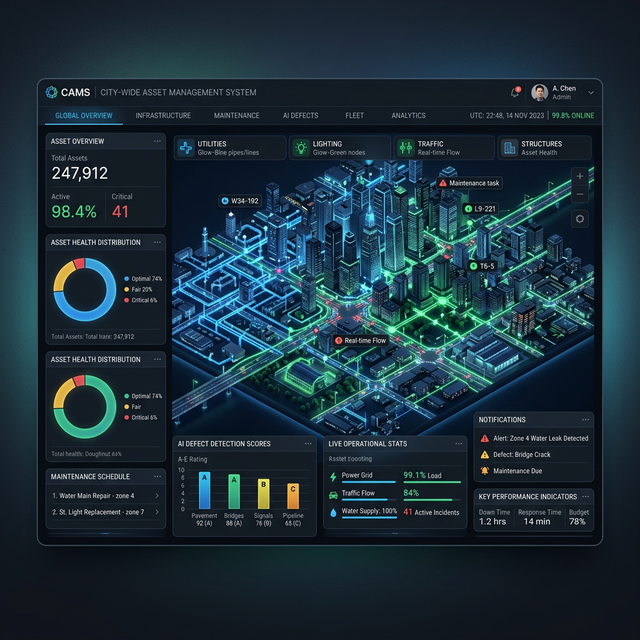
Keeping Track of Assets
It’s hard to fix what you can't find. We use AI to automatically locate and assess everything from cracked pavements to broken streetlights in our imagery, delivering a map-based inventory that helps municipalities know exactly what they have, and what shape it's in.
Protecting Against Floods
Water follows the terrain. We generate ultra-precise elevation maps that help engineers model rainfall and water flow across entire cities, helping authorities design smarter drainage systems and keep communities safe from unpredictable weather.
Accessible City Dashboards
Complex data isn't useful if it's trapped in difficult software. We build simple, secure, web-based dashboards that give city administrators all the location insights they need in just a few clicks, without the hefty price tags of enterprise software.
Relevant Services
FAQ
Ready to map your city?
Tell us about your urban project. We'll get back to you within 24 hours.