Surveying 4,000 Villages: How We Mapped 1,500 sq. km for a Rural Water Mission
A first-hand account of executing a massive drone and DGPS survey across thousands of villages in South India.
Topographical surveys for rural water pipes aren't glamorous. But when you have to map 4,000 villages across 1,500 square kilometers within a few months, it turns into a massive logistical puzzle. Here's how we pulled it off.
The brief
A state government in South India needed to bring piped water to thousands of villages. Before any engineer could design a pump station or size a pipe, they needed detailed topographic surveys of every single village to prepare the Detailed Project Reports (DPRs).
They needed centimeter-level terrain models, orthophotos for laying out the network, and cross-sections along the proposed pipe routes. And they needed it fast, tied to the national geodetic datum.
Trying to do this with traditional total stations and manual DGPS rovers would have required hundreds of field crews and taken years. We went with an integrated drone and DGPS workflow instead.
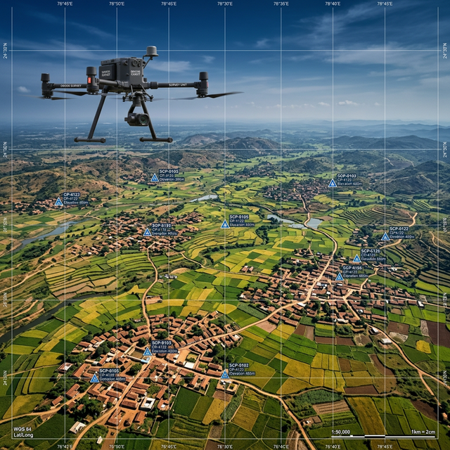
Getting the ground control right
Before we launched a single drone, we had to lock down the ground control network. We set up Primary and Secondary Ground Control Points (PGCPs and SGCPs) across the entire survey area.
This step is tedious, but it's not optional. If you try to run a large-area drone survey without rigorous ground control, the processed models will drift—sometimes by meters. A model that looks pretty but is geometrically warped is useless to an engineer trying to calculate water pressure. We placed PGCPs every 5 to 10 km and SGCPs every 1 to 2 km.
Flying the grid
Once the control points were set, our drone teams moved in. We ran a rolling program, covering multiple districts at the same time. We flew the drones low enough to get a Ground Sampling Distance (GSD) of 5 to 8 centimeters, which is more than enough detail to generate the Digital Elevation Models (DEM) needed for pipe planning.
We were constantly adjusting flight plans. Hilly areas needed higher overlap so the processing software wouldn't lose track of the terrain. We had to dodge local agricultural seasons to keep crops from obscuring the ground control targets, and we had to chase down local flight clearances district by district.
Crunching the data
The drones capture thousands of images, but the real work happens on the servers. We processed the raw imagery into dense point clouds, clean terrain models, and sharp orthophotos. Finally, we pulled the cross-section data along the specific routes the design team wanted. We packaged the deliverables so the engineers could drop them straight into Civil 3D and EPANET.
The logistics of scale
When you scale up to 4,000 villages, the technical problems become logistical problems. We had parallel field crews operating across multiple districts. Managing the raw data upload from remote locations was a daily battle. Getting DGPS rovers to some of the toughest terrain required a mix of 4WD vehicles and simply hiking in. And since we were working around monsoon season, our flight schedules had to stay incredibly flexible.
The result
The survey data fed directly into the design of water supply schemes worth around ₹850 Crores. The engineers designed the hydraulic networks using actual, accurate terrain data. They chose reservoir locations based on reality, not guesswork, and optimized the trunk mains to save on excavation costs.
If there's one lesson from a project this size, it's that survey data is only useful if it arrives before the design team actually needs it. Delivering the perfect survey three weeks late delays everything.
Working on a large-scale survey project? Get in Touch →